L-A-D Foundation - Land Stewardship in the Missouri Ozark Highlands Since 1962
L-A-D Foundation - Land Stewardship in the Missouri Ozark Highlands Since 1962


Other L-A-D Lands
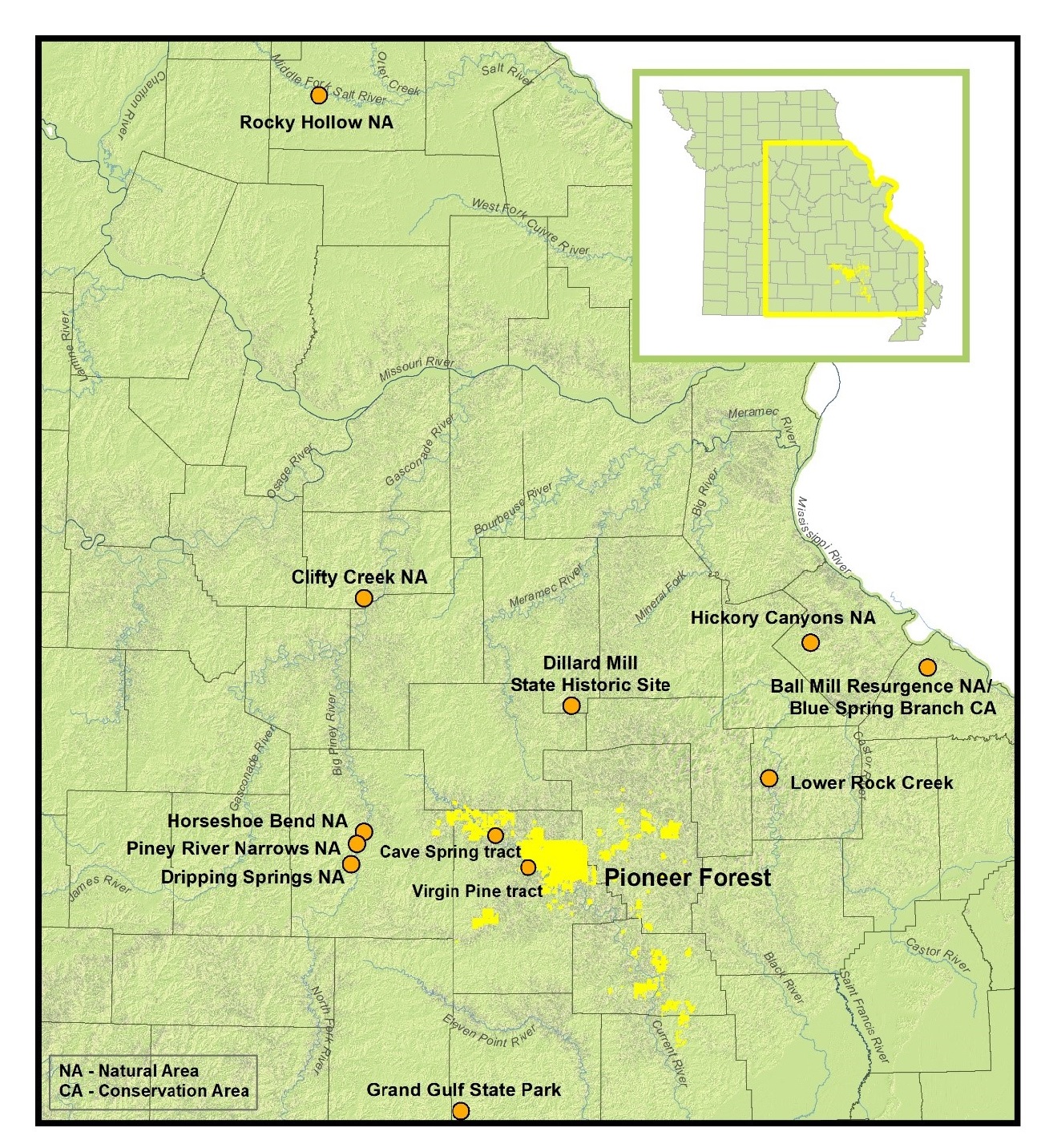
The L-A-D Foundation owns more than 147,000 acres of land; most of that is Pioneer Forest. The Foundation donates leases for its Grand Gulf, Dillard Mill, and Trails of the Roger Pryor Pioneer Backcountry to the Missouri Department of Natural Resources, Missouri State Parks and for seven Missouri Natural Areas to the Missouri Department of Conservation.
See the map below and the links to each area which follow.

An important part of the mission of the Foundation is to protect lands with biological, geological, or cultural resource value. Explore the links below to learn more about these Missouri treasures.
- Ball Mill Resurgence Natural Area, Perry County
- Cave Spring, Shannon County
- Clifty Creek Natural Bridge, Maries County
- Current River Natural Area, Shannon County
- Dillard Mill State Historic Site, Crawford County
- Dripping Springs Natural Area, Texas County
- Grand Gulf State Park, Oregon County
- Hickory Canyons Natural Area, Ste. Genevieve County
- Horseshoe Bend Natural Area, Texas County
- Piney River Narrows Natural Area, Texas County
- Riverways Corridor Lands
- Virgin Pine, Shannon County
© 2013-2023 L-A-D FOUNDATION ♦ 725 KINGSLAND AVE., SUITE 100, ST. LOUIS, MO 63130 ♦ 314-621-0230 ♦ EMAIL: INFO@LADFOUNDATION.ORG
PIONEER FOREST ♦ PO BOX 497, SALEM, MO 65560 ♦ 573-729-4641
♦ SEE PRIVACY POLICY
This site maintained by Craig Technology Consulting • 201 E. 4th St. • Salem, Missouri 65560 • PH 573.453.2322