L-A-D Foundation - Land Stewardship in the Missouri Ozark Highlands Since 1962
L-A-D Foundation - Land Stewardship in the Missouri Ozark Highlands Since 1962


Ball Mill Resurgence Natural Area and Blue Spring Branch Conservation Area, 368 acres

PHOTO BY: Greg Iffrig

Blue Spring Branch is a small stream originating near Brewer and crossing the Perry County Karst plain for roughly five miles, joining Bois Brule Creek in the floodplain, and eventually emptying into the Mississippi River.
This is the northern edge of the Missouri ecoregion known as Perry County Karst. This unusual landscape extends for at least 25 miles through Perry County, from the southern edge of Ste. Genevieve County south into Cape Girardeau County, and includes thousands of sinkholes, sinkhole ponds, losing streams, springs, caves, and resurgences. Missouri is a cave state and here in Perry County are more caves than in any other county in the state, and the longest in Missouri.
The L-A-D Foundation’s 19.7-acre Ball Mill Resurgence (above) was acquired from two adjacent landowners by Leo Drey and donated to the foundation in 1978. It was designated as a Missouri Natural Area in 1979. For many years the goal was to add buffering land. Beginning in 2007 and through the end of 2018, a series of five transactions added stream frontage along Blue Spring Branch, springs, sinkholes, resurgences, and upland karst plain. To date the L-A-D Foundation has acquired 368 acres in two separate units and donates its lease of these lands to the Missouri Department of Conservation for management as Blue Spring Branch Conservation Area.

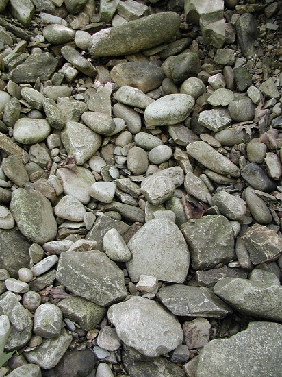
PHOTO BY: Greg Iffrig

In the late 1990s and early 2000s there were several fish kills of a sculpin known from cave streams in this area. It prompted a review by the US Fish and Wildlife Service and research on the distribution of the sculpin, mapping of the flow of water from the surface into the underground, and the genetics of the sculpin. This species has been consistently reported from the surface along Blue Spring Branch and underground from the Berome Moore Cave System which lies beneath the property.
In 2012 a biologist from Arkansas documented and named the grotto sculpin as a unique species and found only in five cave streams in Perry County and nowhere else in the world. It was listed as an endangered species. A few years later and local officials began a working group of local, state, and federal officials and others to produce an unprecedented “community plan” which was approved by the US Fish and Wildlife Service. Other contributors to this unusually effective partnership in support of the recovery of the grotto sculpin, improve water quality, and clean up sinkholes regionwide includes Cave Research Foundation, Missouri Department of Natural Resources, Missouri Speleological Survey, Southeast Missouri Regional Planning Commission, University of Missouri Extension, and USDA Natural Resources and Conservation Service. Blue Spring Branch Conservation Area serves as critical habitat for the grotto sculpin and provides for public education, wildlife observation, nature study, and outdoor recreation including hunting.
The Missouri Department of Conservation has worked to restore species of native grasses and dozens of forbs on the gently rolling landscape of mixed savanna and grassland. The success from seeding and prescribed fire shows along trails (far left) which are mowed across the grassland where in the spring you can see beardtongue in bloom (right), and through the summer compass plant, cup plant, Maximillian sunflower, and rattlesnake master. There is a small savanna with wide-spreading post and white oak. Prescribed fire also is being used to control invasive plants, including Japanese and bush honeysuckle and wintercreeper, and restore natural conditions.


PHOTO BY: Greg Iffrig
There is a well-developed loop trail at the resurgence, which leads visitors around several karst windows, crossing the hilltop before heading down to a small bluff. At its base is Ball Mill Resurgence which acts as a traditional conduit for water moving from the surface to the groundwater below (serving as a sinkhole), then during periods when heavy rainfall accumulates below ground the pressure forces the groundwater out at the surface (acting like a spring).
Blue Spring Branch Conservation Area includes the Riney Tract, a half-mile to the north along Perry County Route 916. Across the county road from the parking area visitors stand atop a loess-mantled point enjoying the expansive view across the Mississippi River valley to the bluffs in Illinois. Those willing to explore may go down the hillside to cross Blue Spring Branch. Across the branch is a large, and often wet, bottomland undergoing self-restoration to native forest. Several cave openings, numerous karst windows, a small spring, and another small resurgence are found here.

Above: The expansive view from this high point at the Riney Tract is across the Mississippi to the river hills in Illinois. The tallest point along the skyline is nine miles away in Chester, IL. PHOTO BY: Neal Humke.

Along the well-developed trail leading to Ball Mill Resurgence Natural Area there is a plaque commemorating Jerry Vineyard. Jerry spent his career working for the Missouri Geological Survey, provided leadership to the Missouri Natural Areas System, and served as a member of the Board of Directors of the L-A-D Foundation for 20 years. His work significantly advanced public understanding of caves, karst, and geology in Missouri, and he was a pivotal factor in Leo's decision to purchase Ball Mill Resurgence. Jerry continued seeking protection for Perry County Karst, especially along Blue Spring Branch, his whole life. He was elected Director Emeritus to the L-A-D Foundation in 2017 following his retirement from the board. He passed away in April 2017.
The L-A-D Foundation recognizes other Missouri conservation leaders at its Pioneer Forest office in Salem, Grand Gulf State Park, Hickory Canyons Natural Area, Rocky Hollow Natural Area, and in the naming of our Roger Pryor Pioneer Backcountry.
Directions. The property is about an hour-and-a-half south of St. Louis. Follow Interstate 55 south to Highway 51, turn east into Perryville to Highway 61, turn north on Highway 61 and go about one-half mile to Route V and turn east, go 2.8 miles to a fork in the road. Take the east fork onto Perry County Route 916. It is about a mile to the Ball Mill Resurgence parking area and the Shafer Tract on the side of the road. Blue Spring Branch Conservation Area lies between Perry County Route 914 on the west and Perry County Route 916 on the east.
For more information about Ball Mill Resurgence Natural Area see https://nature.mdc.mo.gov/discover-nature/places/natural-areas/ball-mill-resurgence and for more information about Blue Spring Branch Conservation Area click https://nature.mdc.mo.gov/discover-nature/places/blue-spring-branch-ca.
© 2013-2023 L-A-D FOUNDATION ♦ 725 KINGSLAND AVE., SUITE 100, ST. LOUIS, MO 63130 ♦ 314-621-0230 ♦ EMAIL: INFO@LADFOUNDATION.ORG
PIONEER FOREST ♦ PO BOX 497, SALEM, MO 65560 ♦ 573-729-4641
♦ SEE PRIVACY POLICY
This site maintained by Craig Technology Consulting • 201 E. 4th St. • Salem, Missouri 65560 • PH 573.453.2322